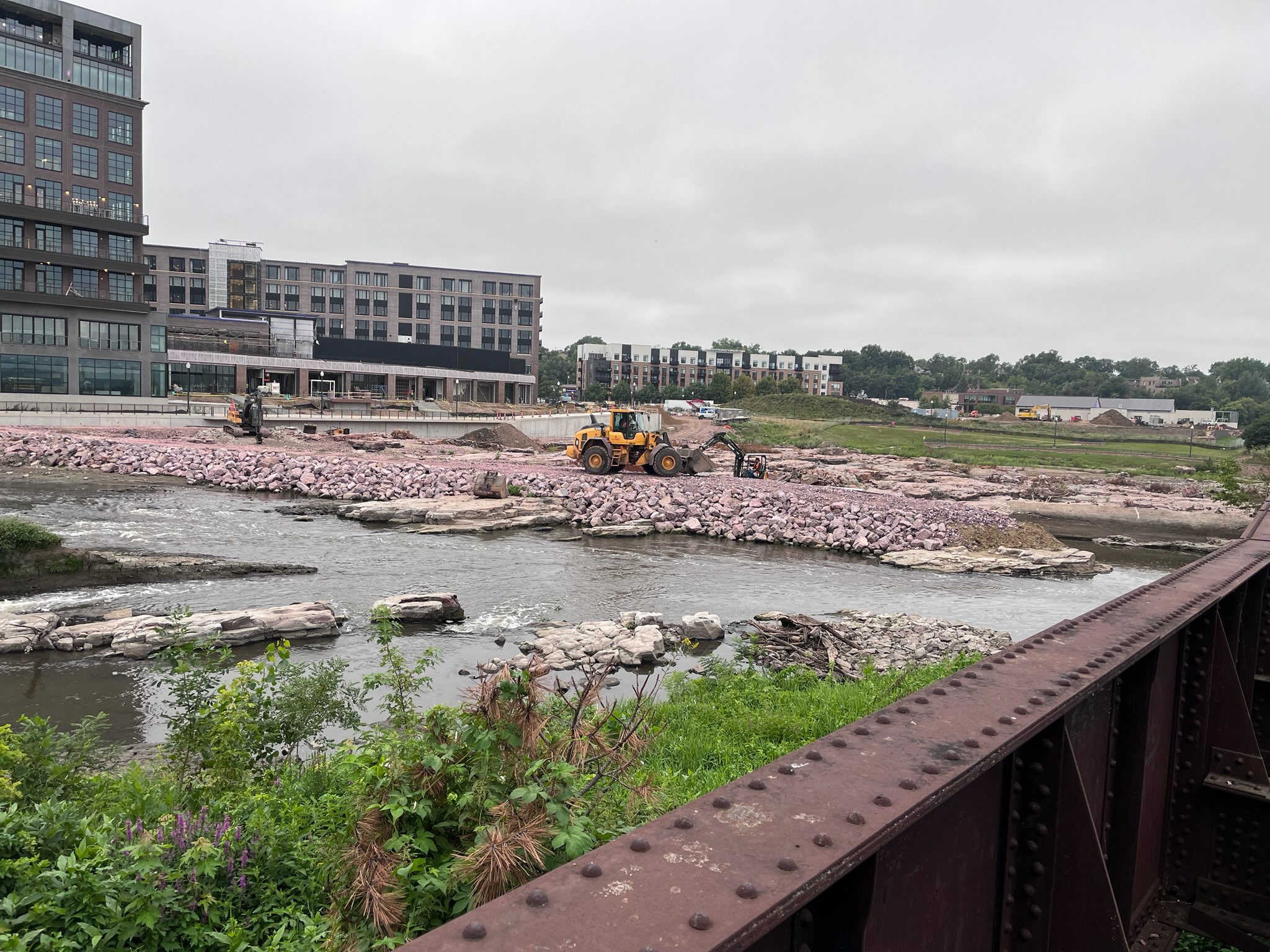
UPDATE: I got this picture this morning. As you can see the core of the dike is dirt. Not sure if they are going to build a concrete bulkhead on the west side of the wall, because if water ever goes over the wall with heavy rains it will just washout the dirt core and collapse the wall. Maybe that is by design? I don’t build diversion walls so I have NO clue what I am talking about, but does anyone else know if this is the proper way to build this? Seems like the two dudes working on it today looked like they were in a race against time.
So a foot soldier sent me an interesting email about the diversion channel the city is building by the Sioux Steel District. This was planned and not something the city was hiding;
Yesterday – Saturday – I walked on the recreation trail downtown to Falls Park. As I passed under the new Sixth Street bridge, I noticed that the river now has what looks like a diversion “wall”. It has pink quartzite rocks and concrete. I examined it more when I reached Fall Park and stood on the overlook deck. It looks like the river now flows under only one portion of the railroad bridge and no longer can flow freely under the whole thing. I’m not a fan of changing the flow of a river that nature created. Do you have any information how the construction company or property owner was allowed to build that diversion wall? In my opinion, it’s unbelievable that it was built – the flooding in June should have put that project on hold.
Sioux Falls will have future heavy rain events and water will make its way to the falls and will only have a narrow channel in which to flow. This is ridiculous.
I don’t know enough about how this all works, but I would like to know IF the Corp gave permission, and if so, if they are aware of how this will work?