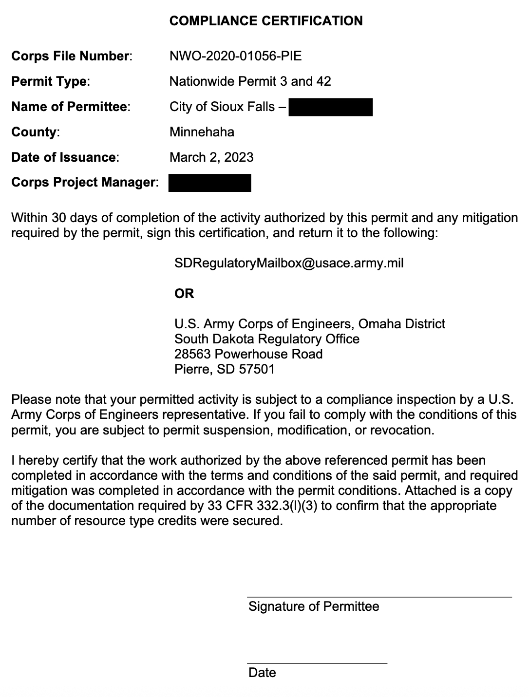
Bruce Danielson did a FOIA (Freedom of Information Act) request with the US Army Corps of Engineers to receive information regarding the planning and replacement of the low head dam at Falls Park (click on links to see full PDF docs throughout article);
Any and all documents permitting the City of Sioux Falls or their contractor businesses, giving permission to modify the flow of the Big Sioux River and the falls in downtown Sioux Falls between 2015 to current.
I have been reviewing the materials received from the CORPS over the past month. The PERSONAL names of any parties involved have been redacted BUT, all other pertinent information was provided. What disappoints me the most (but not surprised) is that a constituent had to go to the Federal Government to get information about how the city is handling a local project. Since the city is working within a waterway controlled by the Feds this information really should be also provided by the city to the public, but was NOT. I don’t think it is the responsibility of the Feds to inform local constituents on projects our city is doing in concert with their pre-approvals. To get to this point took decades, and the public wasn’t really brought along on the process, as you will see in some of the docs I reviewed.
Some major concerns about the project;
• Who is funding this project? How much will it cost and what ‘fund’ is this coming out of (Ex: Jacobsen Plaza or Parks Department or Planning Department). I couldn’t figure out what city agency is handling this project. It seems to be Planning, but their is NO clear agency.
• Will it work? I find it troubling that this area has been almost the same for 100 years, and while Falls Park does flood almost yearly, you wonder if this will be a good flood control measure or will it just back water up towards the South and the East?
• How was historical and environmental mediation handled? (there was opposition to the project at first, but a solution was presented, just not sure what it was or how they came to the conclusion to proceed).
• It seems the project must still go thru final approval with the Feds once the project is completed and up until this point the only thing the city has gotten is pre-approval to proceed. In other words the Feds could institute major changes to the final project once the inspection is completed, or could have a ‘wait and see’ approach to see how it handles major floods/rains, etc.
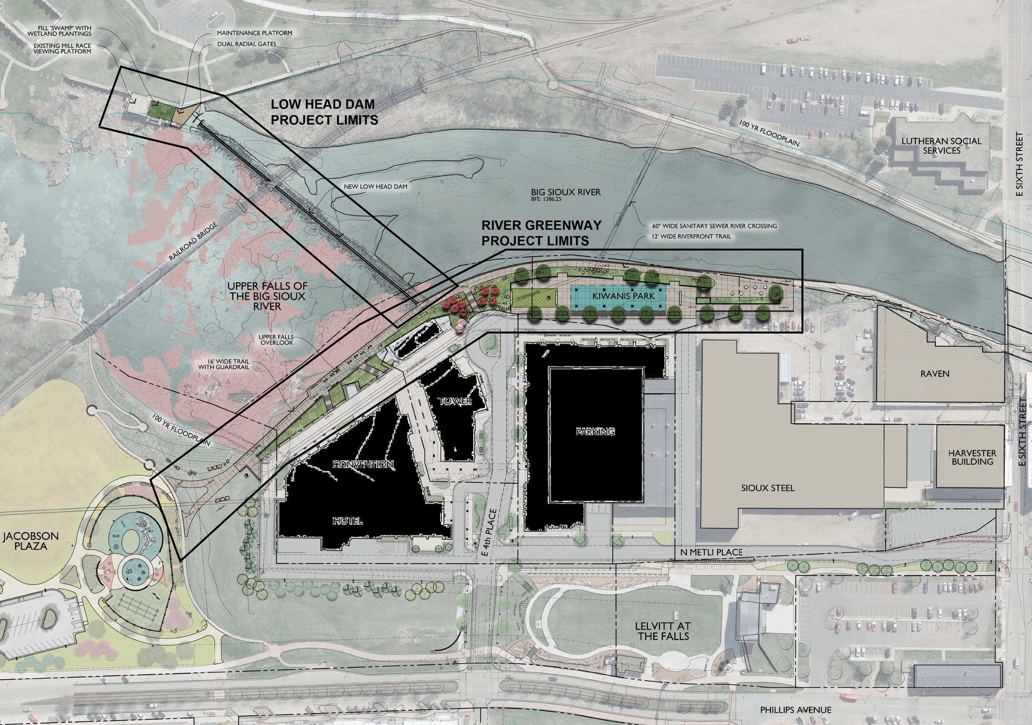
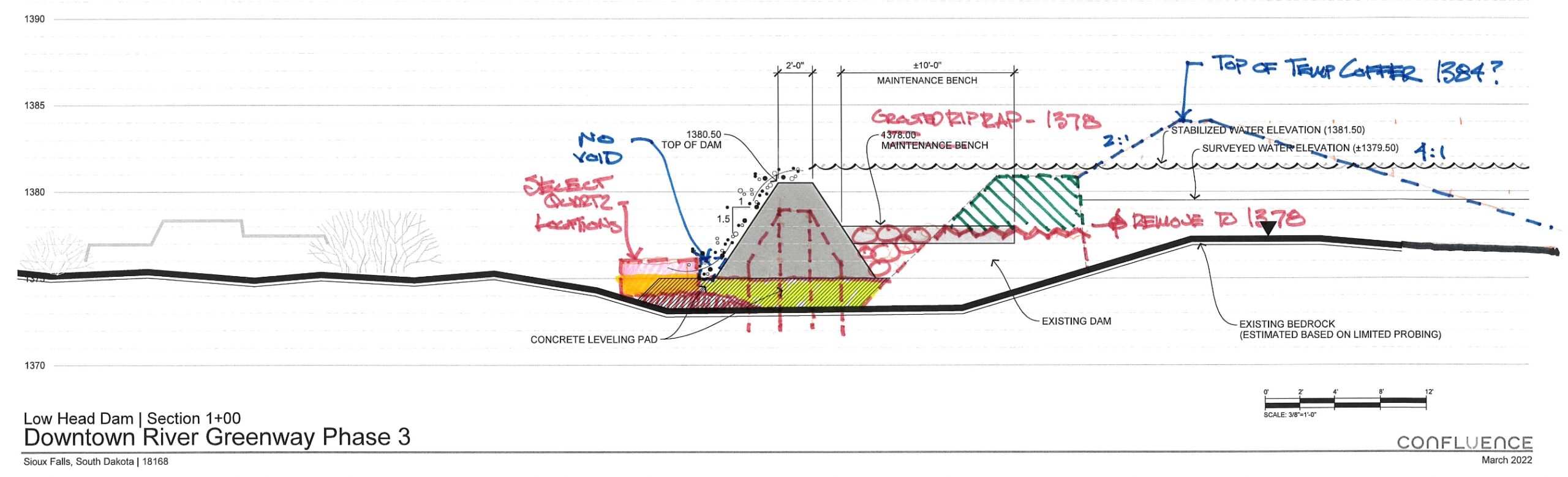
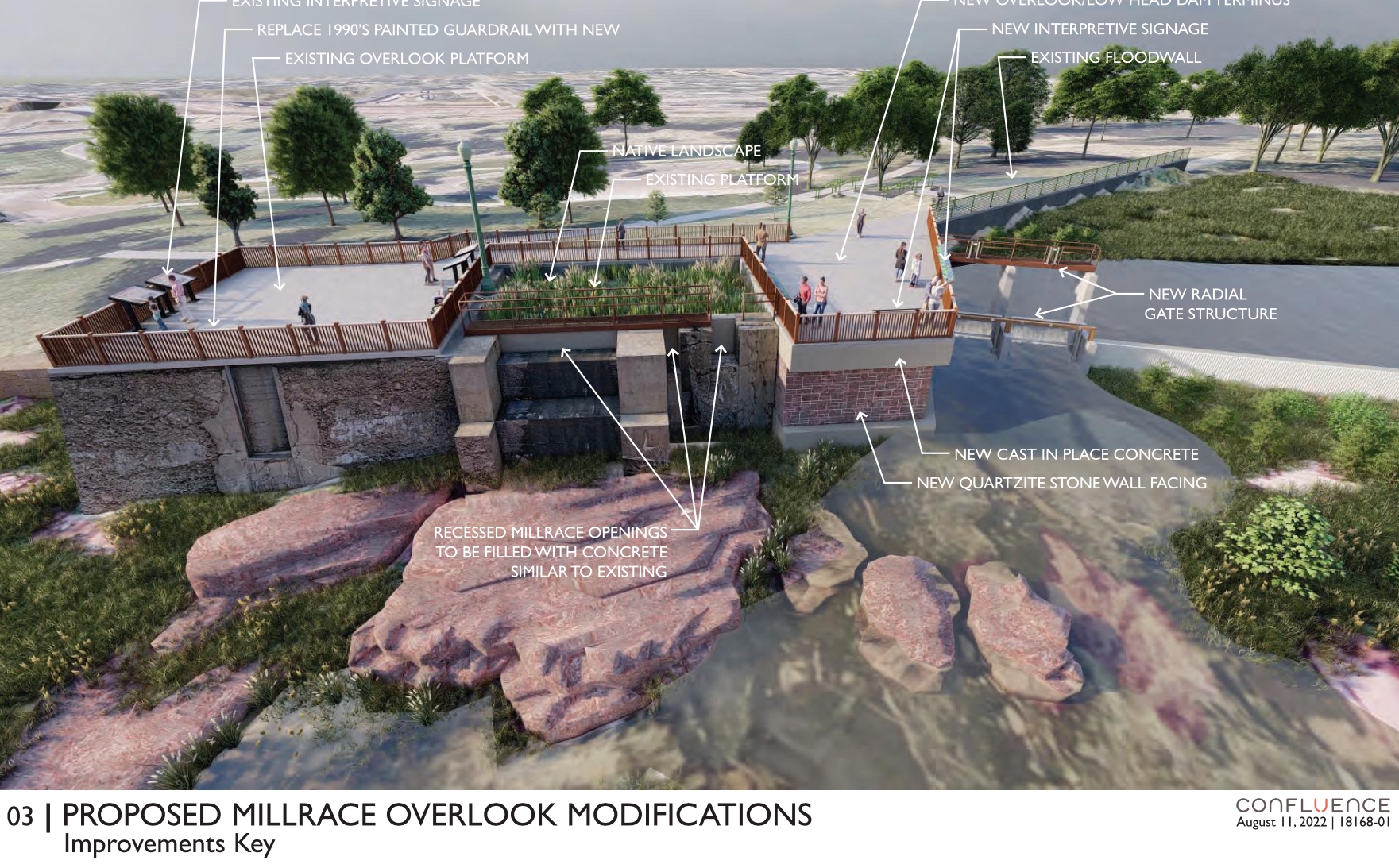
These are images of the original ‘plans’ for the replacement that the city OR the CORPs initially called a ‘rehabilitation’ of the low head dam (it is NOT a rehab, it is a total replacement). Also notice the drawing of the dam is a straight line (this will come up later in the post).
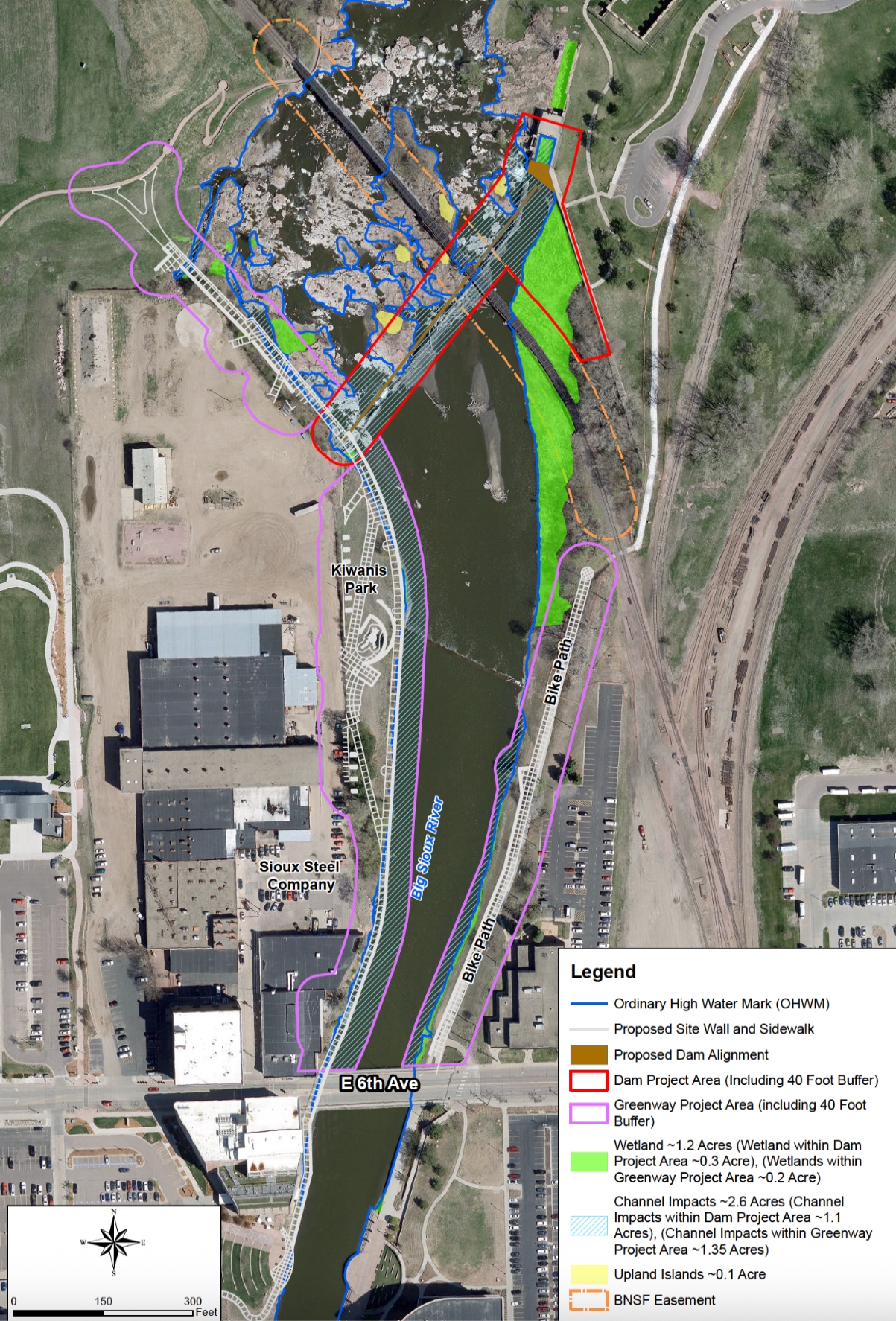
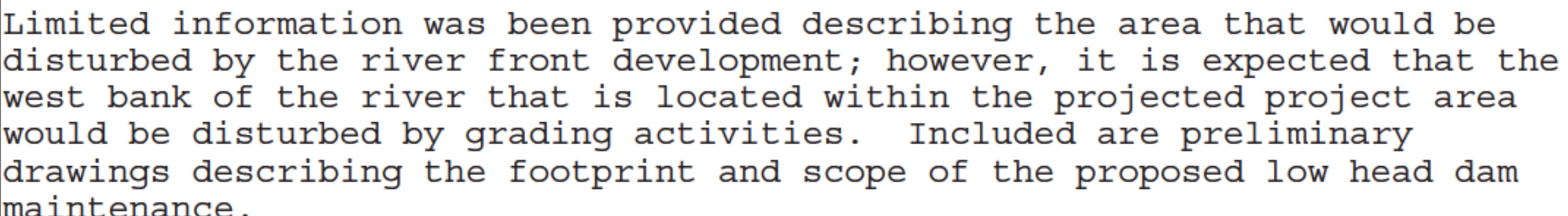
Below is the IMPACT MAP which shows wetlands on the East Side. Before the CORPs signs off on the completion of the replacement of the dam, the city will have to create a new wetland area on the east side as requested by the CORPs.
Scope of work performed at or around Falls Park in coordination with the CORPs
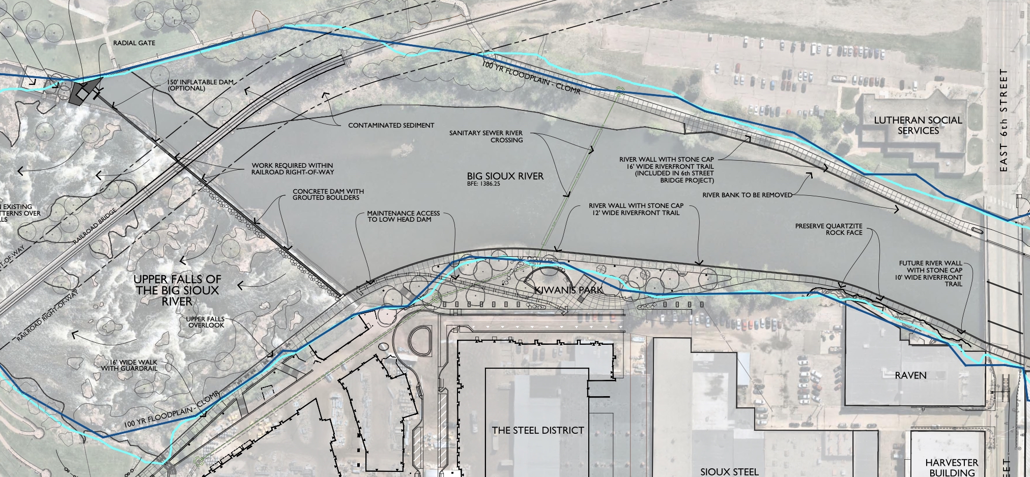
As you can see from the diagram below, after the old dam was removed they made the replacement damn LOWER then the original;
Many agencies were asked to weigh in on the proposed replacement, HERE are some recommendations for PRE-APPROVAL;
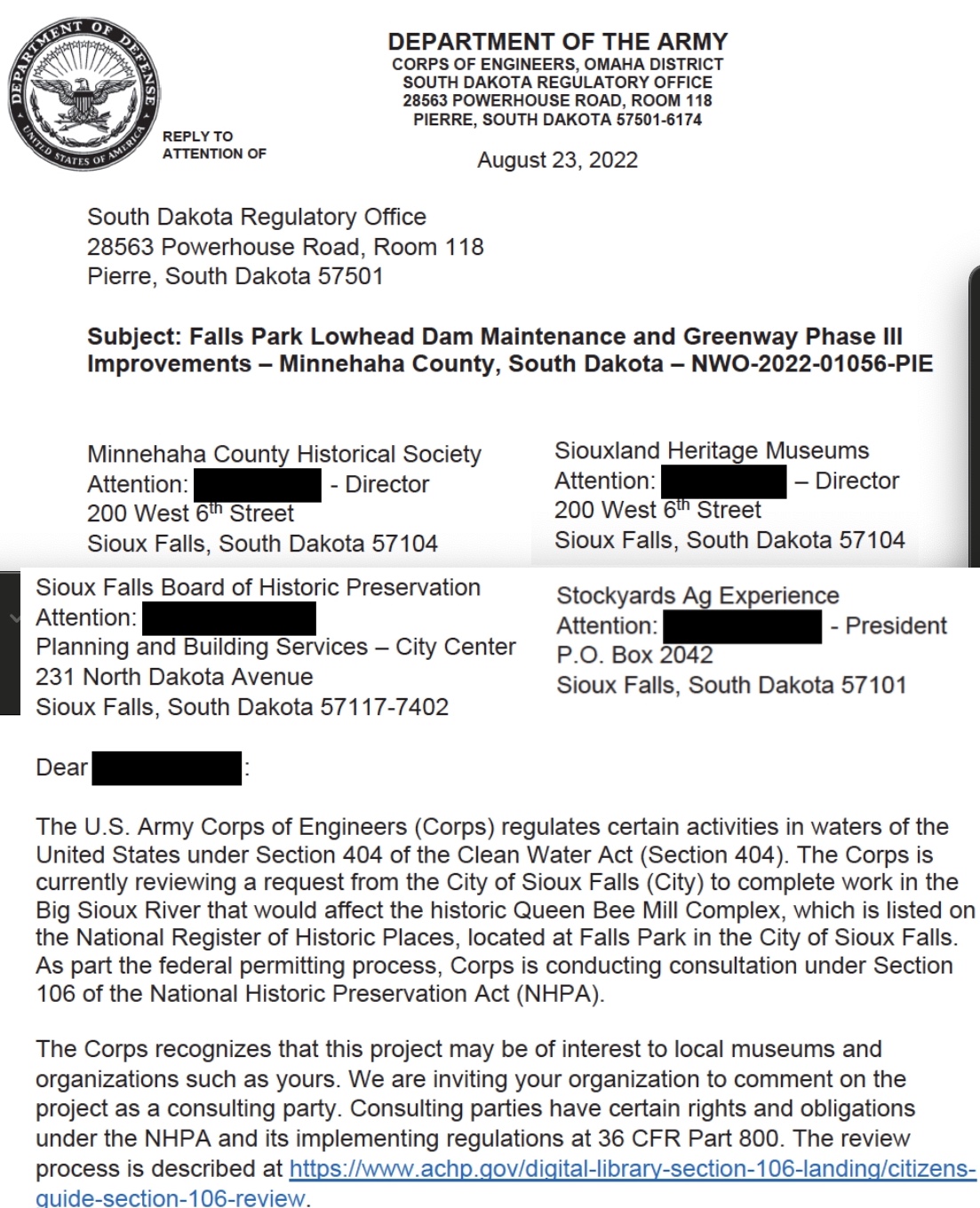
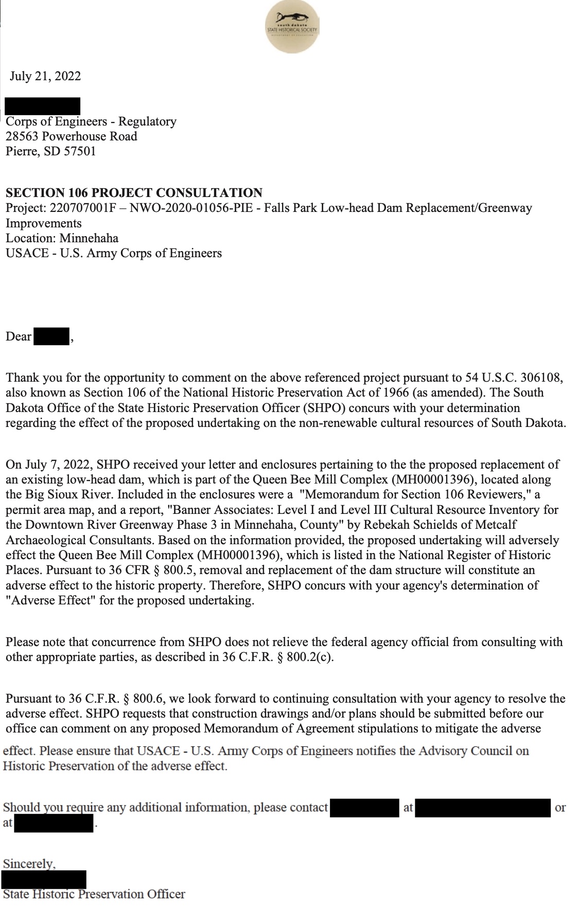
As you can see below the State Historical Society (a state agency) had concerns about the adverse impacts of the dam replacement AGREEING with the CORPs, then offering to work on a solution (NOT sure what was resolved or how this recommendation got reversed) THIS IS the full SDSHS review;
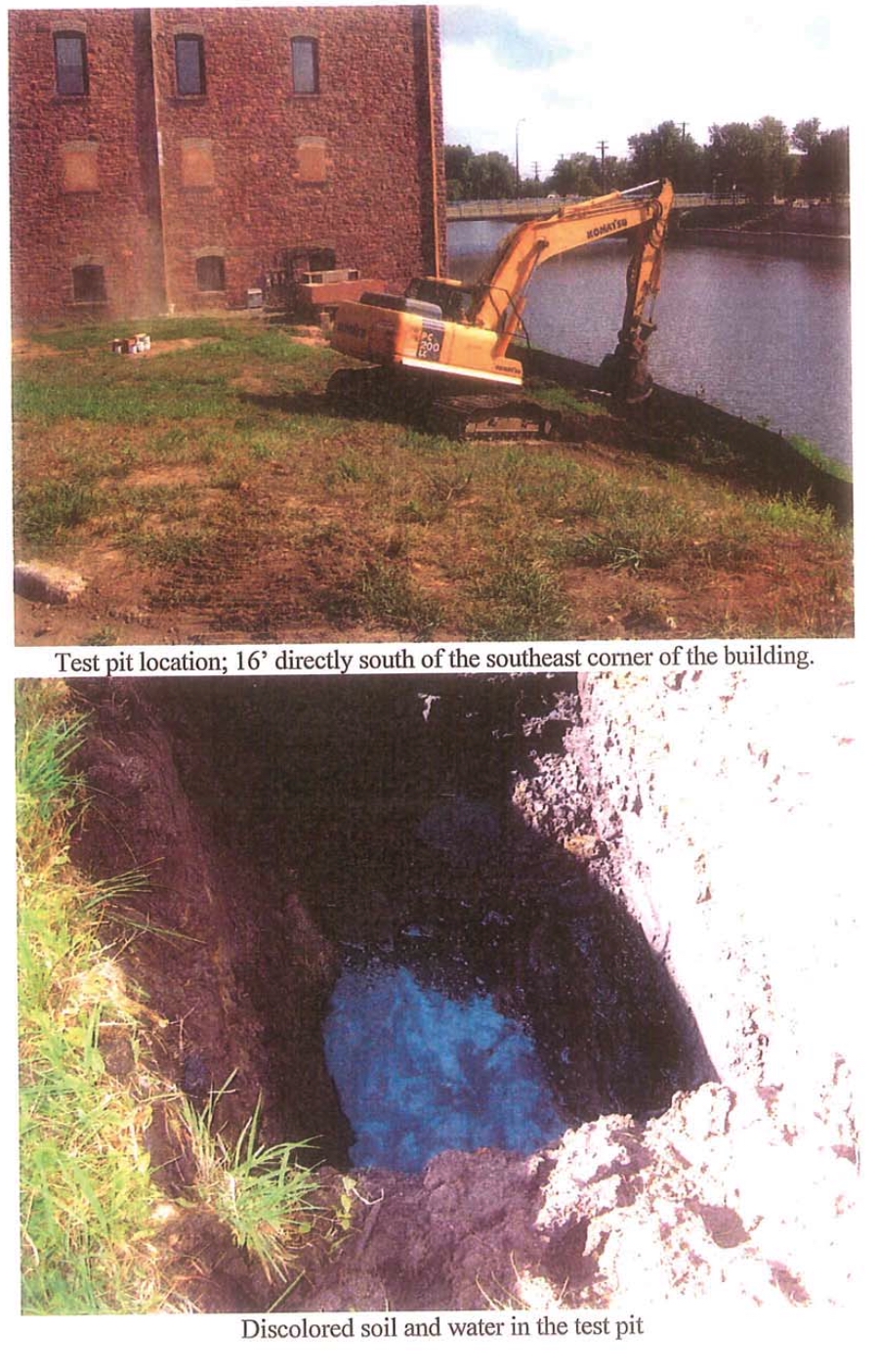
Somehow the 6th Street bridge environmental review was also done before construction could be done on the bridge, and look at this wonderful soil sample they found below. As I have said in the past, almost all of the dirt and quartzite in this area of Falls Park is severely contaminated from years of chemical waste and river runoff only a few feet under the surface. It still amazes me that we continue to ‘pave over’ our beautiful Greenway instead of highlighting it’s natural beauty. I have suggested instead of all these super condos along the greenway we should put down a wide pea rock path that winds thru natural prairie flower gardens and other natural amenities, and the best part it only needs rain and sunshine to be maintained. With all the contamination under the ground in this area of DTSF you would think permanent structures would NOT be allowed by any government agency, state, local or Federal. This is why the Levitt shell is where it is, because of the massive contamination of that site, they can’t build a permanent structure on the grounds. Don’t think we have ground water issues in this area? Then why are they always tearing up the sprinkler system at the Levitt every year since it has been opened? It seems about once a month in the summer, they have some pipe torn up at the Levitt and the culprit is usually a leaky sprinkler system pipe;
Where we start running into issues is the original design of the replacement has been drastically changed. This is the original plan submitted to the CORPs;
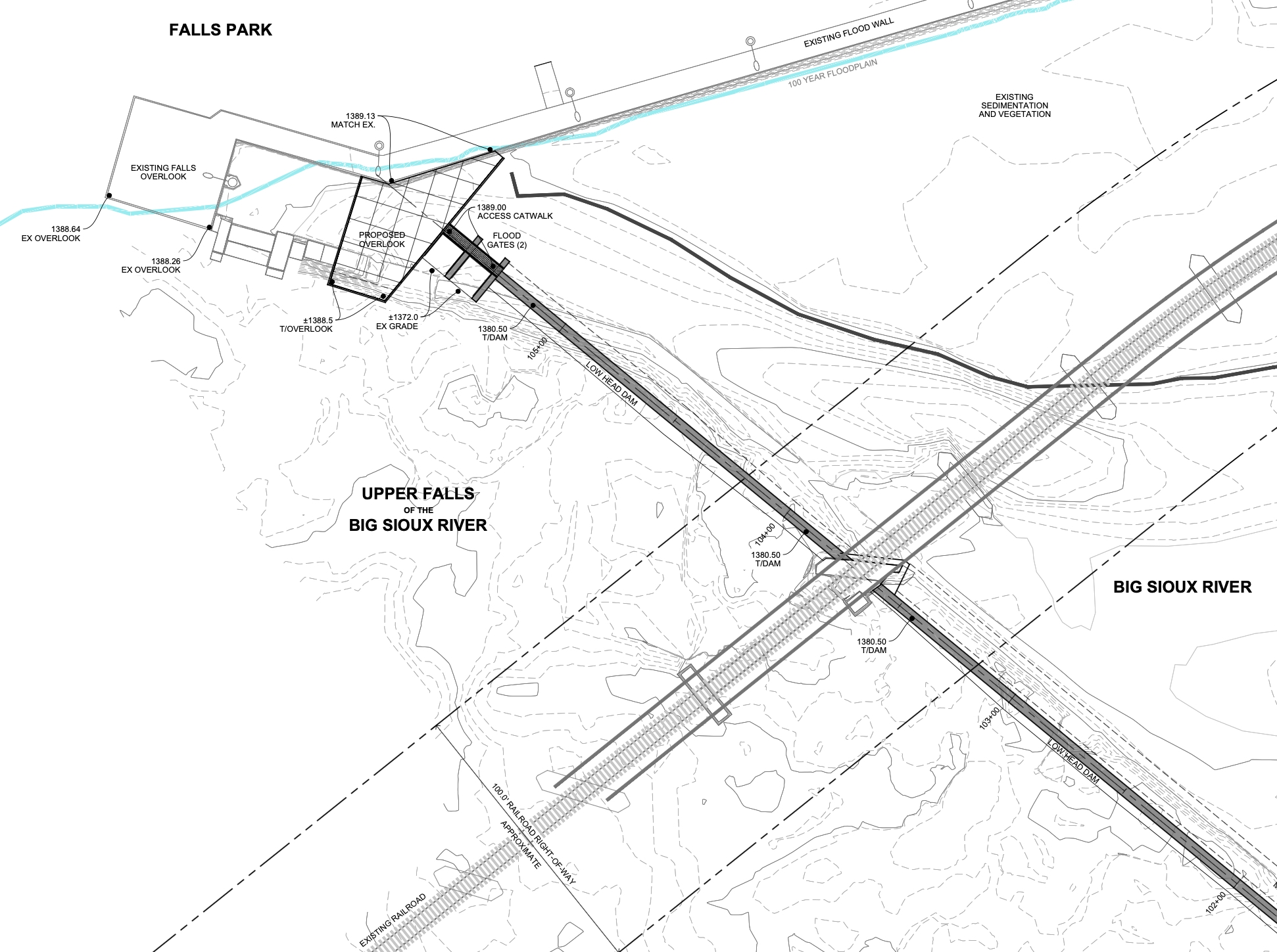
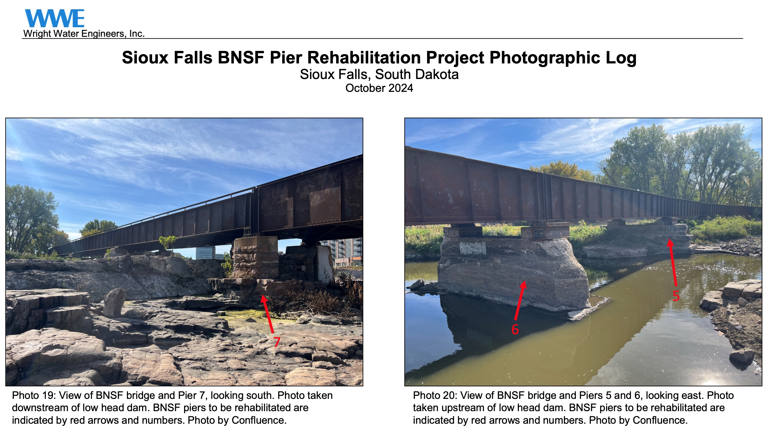
As you can see, the replacement dam is supposed to run in a straight line from the banks of the Steel District to the old Queen Bee Mill structure, those plans have changed. Also notice the carve out around the pier below is about a foot higher then the rest of the dam on the North and South sides. I find it troubling that this was the solution concocted by the railroad, the city and the CORPs. If we get a major flood, like we do almost every Spring due to snow melt and rain, this pocket behind the pier will just fill with debris and tree trunks and I would assume rise up to cause issues with the bridge itself. Still scratching my head why the plans changed so drastically? Was this pier determined historical (built around 1900) and maybe the compromise the historical peeps were looking for? Which is also strange since other original piers were encased with concrete. Once the CORPs approves this I will be curious to see how this came about.
As you can see from the above picture they made a turn around the one pier (not sure why they didn’t just encase the Pier and put the dam up against it instead) they did encase two other piers to the east of this one;
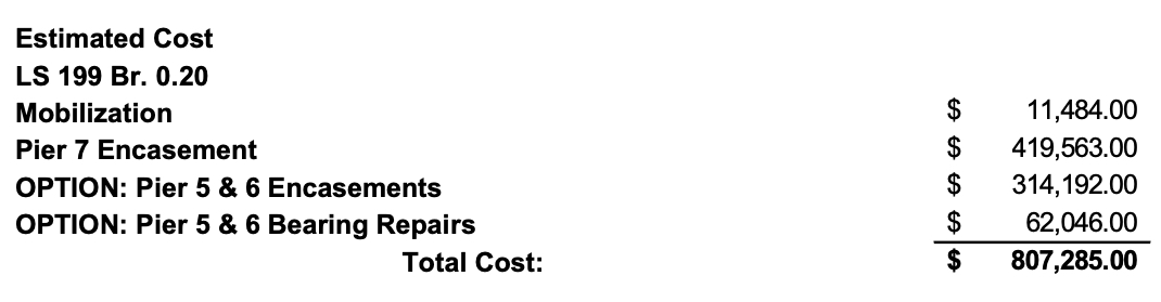
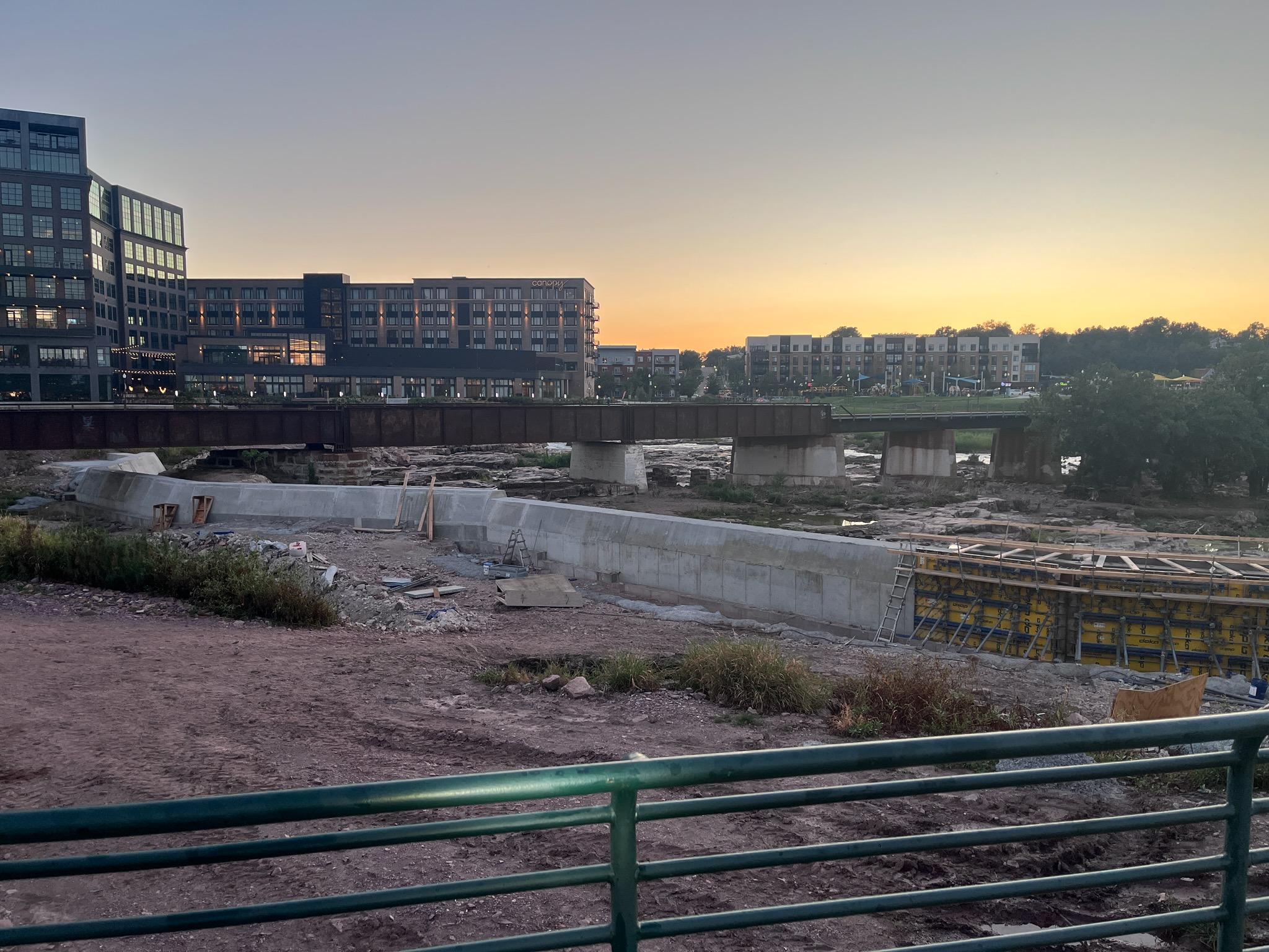
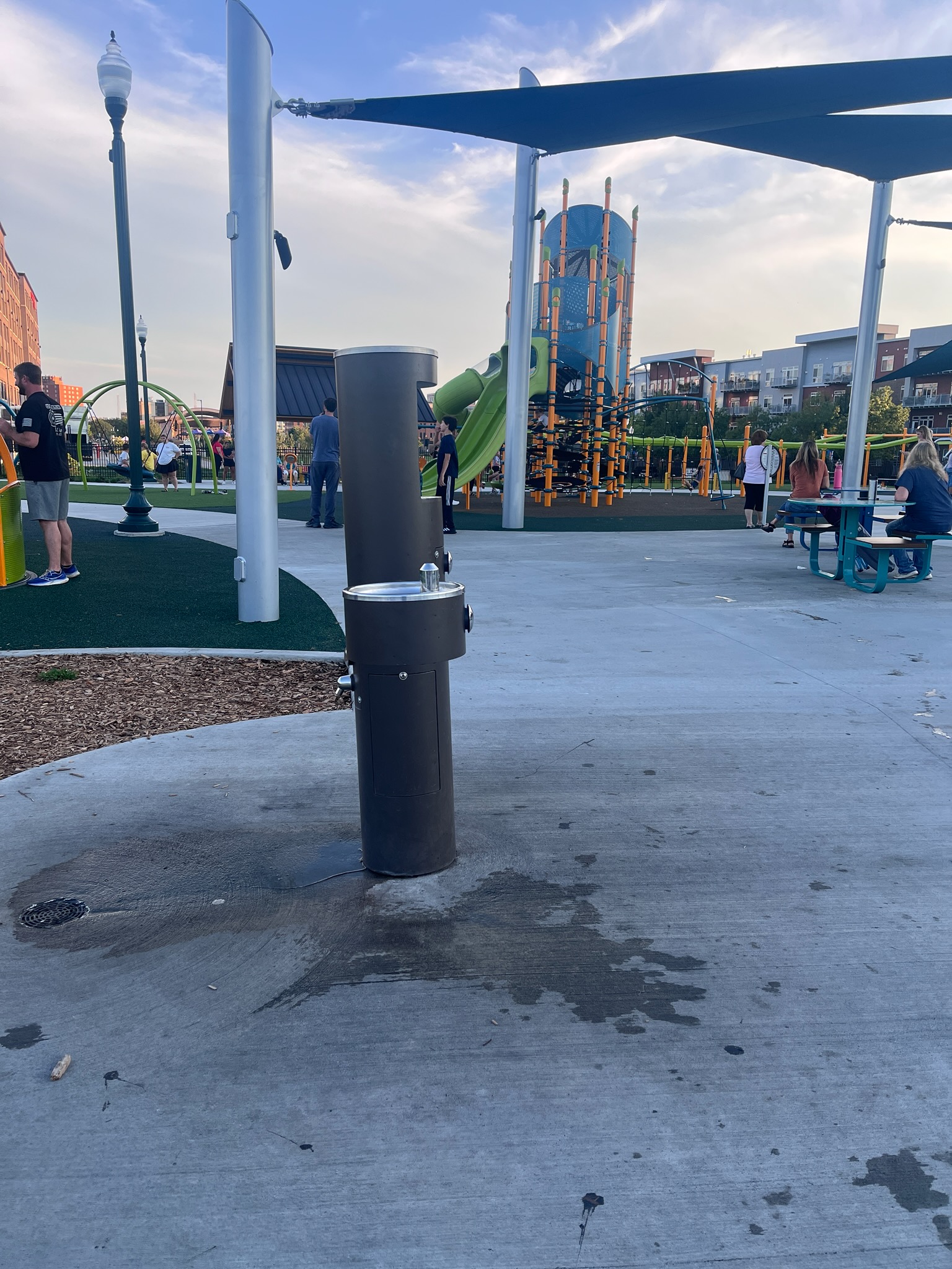
Look at the almost ONE MILLION just to encase some Piers. While we have been ‘told’ that the Jacobsen Plaza project was $16 Million there was significant cost overruns with this dam replacement and we may never know how much it was. Apparently $16 Million wasn’t enough to install a water fountain that is level (I call it the Leaning Water Fountain of Jacobsen). The irony is if you go around to other parks in Sioux Falls that have had upgraded equipment over the past few years, much of the equipment is broken now. The electronics on the machines at Rotary Park haven’t worked for over 2 years (this park is only 3 years old). It makes you wonder if the entire parks budget was thrown at this entertainment superplex while cutting back on repairs and maintenance in other parks;
They also intend to build another observation deck over the flood gates next to the Queen Bill Mill;
The good news is it appears that the Feds only do a pre-approval so work can be done, but don’t sign off final approval until final inspection which I don’t think will be until the end of 2026 with all the extra dirt work they have to do;
I have been mystified by this project since it’s beginning and the lack of information I have gotten from the city. I have many more questions;
• Why was this called a ‘rehab’ by the city when it is a total replacement?
• Why did plans change to go around the pier instead of up against it?
• Why was only half the dam poured then an expensive coffer damn put in to complete the project (there seemed to be a long delay between the pouring of the first leg of the dam and putting in a coffer dam to complete the project)?
• What was the compromise between historical advisors and the changed plans?
• Where is the money coming from to replace this? The Railroad? The City? The Developer? The Feds?
• How are environmental concerns being mediated?
I will be curious if and when the CORPs signs off on this project. Because right now, it looks like a gigantic mess. I used to work construction, and it is common to change architectural and engineering renderings in the field so they will work with the project, but it seems this project didn’t have a clear objective from the beginning and they are making changes on the fly and this is why it is starting to look like a cobbled mess. I also found emails between private contractors, city employees and the Feds interesting. The Feds are always detailed and professional in their emails and only are interested in brass tacks, can’t say the same about the others involved with the project. I guess we will have to wait until the project is finished before we see positive results, but bringing the public along would help a lot.
In my humble opinion, I would not have handled it this way. No doubt the old dam needed to be fixed or replaced, but wouldn’t you have all the plans ready to go before putting shovels in the ground? I wonder how much all these delays are costing us? Hopefully this post will encourage the council to request a long informational on what is going on with the project, but that would require transparency 🙁